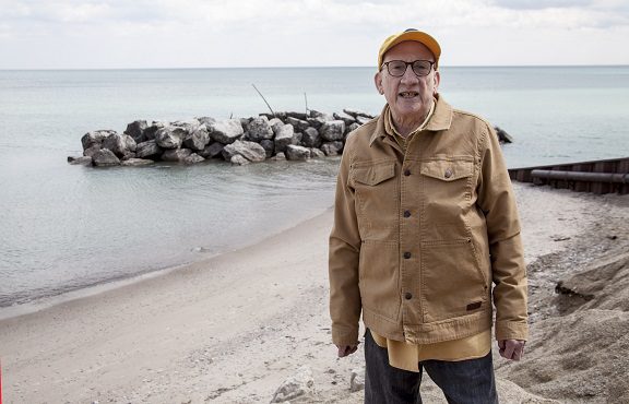
By Jim Rosenbaum
Glacial landforms are easier to appreciate during the late fall through early spring when leafy vegetation does not block sight lines.
I encourage an excursion to the Northern or Southern Units of the Kettle Interlobate Moraine. At Dundee, Wis., the National Park Service’s Ice Age Center is named in honor of the former Congressman Henry Reuss. In 1964, Reuss promoted legislation that established Wisconsin’s Ice Age Scientific Reserve.
In Milwaukee, erosion has exposed a large Silurian fossil reef. This exposed reef is located on the northeast face of the bluff below the old building complex of the Wood Veteran’s Administration.
The reef was described by Increase Lapham in the 1830s, one of the first so identified in the world! It is adjacent to the parking lot at the home of the Milwaukee Brewers, the American Family Field. (See Dott and Attig, 2004, p. 270.) A chainlink fence prevents the public from scaling its rocky face. During the late fall, winter and early spring, when leaves do not obscure its surface, it can be seen from the parking lot.
Niagara dolomite makes an excellent building stone. It composes the walls of the Schlitz-Audubon Nature Center in Bayside, Wis., on the shore of Lake Michigan. Large slabs of the dolomite may also be seen south of the bluff-top parking lot at Klode Park in Whitefish Bay, Wis., where it is used as a landscaping element. The dolomite there has been transported from local quarries.
References cited
Alden, W. C., 1918, The Quaternary Geology of Southeastern Wisconsin, with a chapter on the older rock formations, U.S. Geological Survey, Professional Paper 106, 356 p.
Black, Robert F., 1974, Geology of Ice Age National Scientific Reserve of Wisconsin, National Park Service Scientific Monograph Series Number Two, 1974, 234 p.
Dott, Robert H. and Attig, John W., 2004, Roadside Geology of Wisconsin, Mountain Press Publishing, 345 p.
Farrand, W. R. and Kelley, R. W., 1967, The Glacial Lakes Around Michigan. Michigan Department of Natural Resources, Geological Survey Bulletin 4, 23 p., plus reference table inside front and back covers.
Hansel, A. K., 2004, End Moraines –– End of the Glacial Ride, Geobit 2. Illinois State Geological Survey.
Huber, N. K., 1975, The Geologic Story of Isle Royale National Park, United States Geological Survey Bulletin, 1309, Wikimedia Commons
Kelley, R. W., and Farrand, W. R., 1967, The Glacial Lakes around Michigan, Michigan Department of Natural Resources, Geological Survey Bulletin 4.
Linebeck, J. A., Gross, D. L. and Meyer, R. P., 1974, Glacial Tills Under Lake Michigan. Illinois State Geological Survey, Environmental Geology Notes Number 69, 48 p.
Luczaj, J. A., 2013, Geology of the Niagara Escarpment in Wisconsin. Geoscience Wisconsin, v.22, part 1, 34 p. Published online.
Luczaj, J. A., 2006, Evidence against the Dorag (mixing-zone) model of dolomitization along the Wisconsin Arch – a case for hydrothermal diagenesis: AAPG Bulletin v.90, p. 1719-1738.
Mainville, Andre and Cooper, Michael R., 2005, Present Day Tilting of the Great Lakes Region based on Water Level Gauges, Geological Society of America, v.117, No. 7/8, p. 1070-1080.
Milankovitch Variations, Wikimedia Commons
Natural Resources Canada and Ontario Geological Survey, 2015, Thunder Bay: Geology of the Lakehead Region; GeoTours Northern Ontario series.
Paulson, et al. – 2007 – Lithospheric Uplift, Wikimedia Commons
Rose, James. 1976, Depth to Dense or Consolidated Alluvial or Glacial Deposits, in Menomonee River Valley Redevelopment Project Area, Department of City Development, Milwaukee, Wis.
Schaetzl, no date, Randy, Geology of the Great Lakes Region, Michigan State University.
Velbel, M., 2009, The “Lost Interval”: Geology from the Permian to the Pliocene, in Schaetzl, R., Darden, J., and Brant, D., eds. Michigan geography and geology Pearson Custom Publishing, p. 60-68.
Walker, W. D., Geissman, J. W., Bowring, W. A., and Babcock, L. E., compilers, 2018, GSA Geologic Time Scale v. 5.0, @ The Geological Society of America.
Acknowledgments:
Dan Patrinos initiated this project for the Wisconsin Marine Historical Society at the suggestion of Carl Eisenberg, WMHS president. Enjoyable to work with, Dan helped me shape the narrative, took the photos, digitized the manuscript for writing and editing, and digitally enhanced many illustrations. Suzette Lopez, WMHS Executive Director, posted the series with its numerous charts to this website.
Deb Bradley patiently typed several of the early drafts.

Leah Rosenbaum created the matrix used in Fig. 1.
The manuscript was reviewed by Ronald W. Tank.
Pamela Mattox reviewed it for style.
Part 1: Is Earth a geriatric case?
Part 2: The rock of ages
Part 3: Wisconsin, a virtual glacial ghost town
Part 4: Post-glacial events
Food for thought, suggested field trips, and references
Photo at top of page: Jim Rosenbaum on the Lake Michigan shoreline at Klode Park in Whitefish Bay, Wis. Photo by Dan Patrinos
______________________
Jim Rosenbaum holds a B.A. from Lawrence University and an M.S. from Stanford University, both degrees in geology. Born in Milwaukee, now living in Whitefish Bay, Jim’s long walks along Lake Michigan and formative years in Arizona and Colorado led to his interest in natural history. An avid sailor, he’s negotiated the coastal waters of Lake Michigan along Wisconsin’s shoreline for many years. An article he wrote on beach erosion was included in Focus on Environmental Geology (1976) and in Environmental Geology (1983), both edited by Ron Tank of Lawrence University and published by Oxford. In the 1980s, he migrated into the book business, from which he recently retired. He also holds a B.B.A. from the University of Wisconsin – Milwaukee. A member of the Wisconsin Marine Historical Society, he also belongs to the American Geophysical Union.

